NISAR satellite for launch
Published on: July 31, 2025 at 01:56
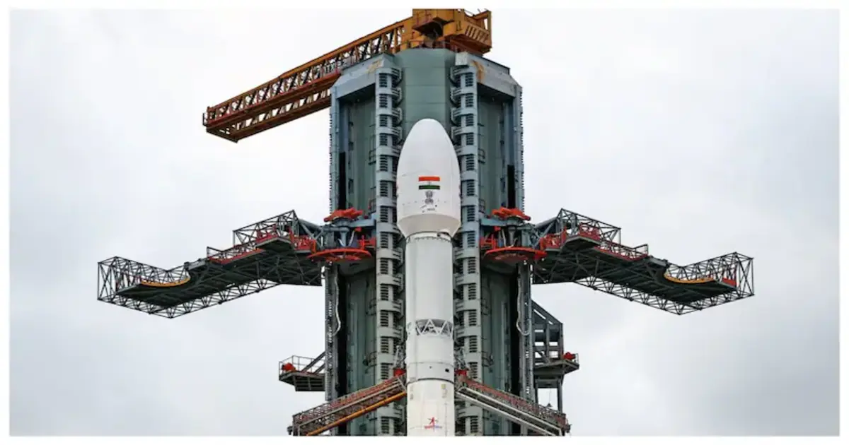
On July 30, 2025, at 5:40 PM IST, India’s GSLV‑F16 rocket successfully launched the NISAR (NASA‑ISRO Synthetic Aperture Radar) satellite. This $1.5 billion joint mission represents a major milestone in Earth observation, combining NASA’s L‑band and ISRO’s S‑band radar technology for the world’s first dual‑frequency SAR system.
Designed to tackle urgent global challenges, the NISAR satellite will help monitor natural disasters like earthquakes, landslides, floods, and volcanic eruptions, while also providing critical data on climate change, glacial melting, deforestation, and soil moisture. This open-access mission is expected to benefit scientists, governments, and disaster agencies worldwide. As India’s most advanced Earth observation mission to date, NISAR reflects the growing strength of India-US space collaboration and promises to revolutionize how we understand and respond to our changing planet.
Also Read:
Tech Announcements August 2025 : Don’t Miss GPT‑5, Pixel 10, Microsoft’s AI Windows Upgrade & More!
What Is the NISAR Satellite?
NISAR (NASA-ISRO Synthetic Aperture Radar) is a cutting-edge Earth observation satellite equipped with L-band (NASA) and S-band (ISRO) radar. It can penetrate clouds, map land and ice surfaces, and track even minor ground shifts—day or night
Why NISAR Matters
-
All‑weather, day‑night monitoring: Penetrates clouds and darkness using advanced radar, capturing detailed imagery every 12 days across Earth’s land and ice surfaces
-
Disaster readiness: Detects ground shifts, landslides, earthquakes, volcanic activity, sea‑level changes, and glacial movements—even at centimeter scale
-
Environmental & climate insights: Tracks forest biomass, soil moisture, wetland changes, ecosystem shifts, and ice sheet dynamics for climate science and policy planning
Launch & Timeline Details
-
Launch date/time: 30 July 2025 at 17:40 IST from Satish Dhawan Space Centre, Sriharikota
-
Orbit specifics: Inserted into a Sun‑synchronous polar orbit at ~743 km altitude with 98.4° inclination—the first GSLV mission to this orbit type .
-
Mission setup: About 90 days of commissioning and calibration will precede the start of full data collection operations .
Technical Innovation
-
Dual‑frequency radar: Combines NASA’s long‑wave L‑band (deep penetration under vegetation and ice) with ISRO’s higher‑frequency S‑band (fine surface imaging) for unmatched versatility
-
SweepSAR technology: Enables wide swath (~242 km) with high spatial resolution (~5–10 m), covering the globe every 12 days
-
Heavy-duty platform: The 2,392 kg satellite uses NASA’s 12 m mesh reflector integrated with ISRO’s I3K bus to deliver robust, global radar imaging
Also Read:
Tech Announcements August 2025 : Don’t Miss GPT‑5, Pixel 10, Microsoft’s AI Windows Upgrade & More!
Global Impact & Applications
-
Disaster management: Provides near real‑time mapping data to aid emergency response during earthquakes, floods, landslides, and volcanic eruptions.
-
Climate & environment: Data supports monitoring of melting glaciers, sea‑level rise, deforestation, carbon sinks, soil moisture, and more
-
Agriculture & infrastructure: Precision mapping of croplands and urban subsidence helps policymakers optimize resource management, crop forecasts, and infrastructure health checks
-
Open data access: NISAR will provide free or rapid-access data (general use within 1–2 days, faster during disasters) to researchers, governments, and NGOs globally
With its powerful radar, real-time data, and international reach, NISAR is a game-changer for Earth science. This historic launch signals a new era of precision monitoring, climate action, and global collaboration from space.